

| 07/03/11, 06/27/20 |
| July 2, 2011 - Page III |
| | | | |
On July 2, 2011, I decided to go to High Line Elevated Park that runs from 30th Street (between 10 and 11 Avenues) down to Gansevoort Street. After walking the entire park, I then went to Governors Island and Battery Park. On my way home, I stopped at a few R & N train stations to photograph the artwork on the walls. Below are the photos of the day. Enjoy!! |


| From 9th Avenue and 33rd Street. You can see Empire State Building (1), Madison Square Garden (2) and Main Post Ofifce (3). |

| Statue, Sacred Heart of Jesus, next to St. Michael's Church, 33rd Street between 9th and 10th Avenues. |

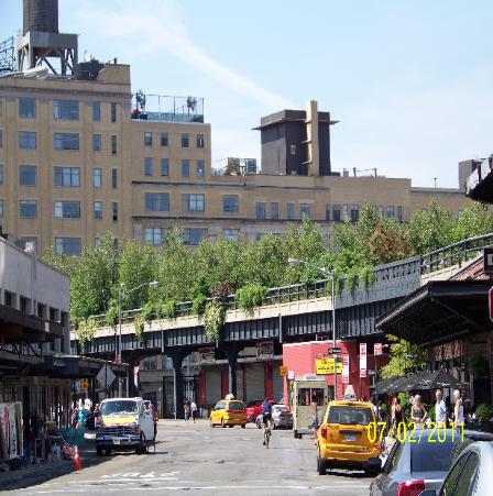
| The end of the old railroad tracks. Entrance to High Line is a few feet from red and yellow globe. |

| From the park one can see the Jacob Javits Convention Center. |


| West 27th Street |


| A bird in one of the bird feeders. |

| 19th Street |

| Chelsea Piers - Sports Complex |


| 10th Avenue and 17th Street |
| 10th Avenue |


| What was once Lackawanna Rail, New Jersey |
| 15th Street |

| The 3 Sisters (a name I made up). |


| The Standard Hotel. 848 Washington at 13th Street The park runs under the building. |


| Do you see the bee? |
| Have no idea what this represents. See no evil? (Update, June 26, 2020: See Page FFFF. This is KAWS.) |


| Looking back at the end/beginning of High Line |
| 13th Street |


The artwork at Whitehall Street Station! (Update - This station was flooded during Super Storm Sandy in 2012!) |


| Could not get the entire sign in one photo! Should have used panoramic mode and then have the photos stitched together. |


| Pier for the Governors Island Ferries. |
| Staten Island Ferry |

| Brooklyn and Manhattan Bridges and heliport from ferry. |

| Brooklyn |

| Approaching Governors Island |


| Staten Island Ferry pulling out. Statue of Liberty. |


| Lower Manhattan with ferry piers visible. |
| New Jersey |


| Governors Island |
| Lower Manhattan from Governors Island |

| New Jersey on the left, Manhattan on the right. |

| Ellis Island |


| As boats passed the island they created waves which would hit the sea wall around the island. |


| Two Staten Island Ferries going in opposite direction. A Royal Caribbean cruise ship can be seen docked in Bayonne, NJ. |
| Lower Manhattan |

| Castle Williams |
| A colorful bus stop look-alike. |


| Metal sculptures in the picnic area. |
| Lighthouse |

| Explorer of the Seas? Royal Caribbean International cruise ship |

| Numbered blocks next to sea wall |

| Brooklyn |


| Back of South Battery |
| Once a church??? Many structures appear to be in disrepair. Some buildings are fenced off. |

| St. Cornelius Episcopal Church |
| Front of South Battery |

| Once a home? Bikes can be brought to the island on the ferry or rented. |


| Inside Fort Jay |


| Fort Jay |


| Castle Williams |


| A boy playing under the bell that is to the left of line waiting to get on ferry to return to NYC. |
| Waiting on line to get on ferry back to Manhattan |


| East Coast Memorial. Clouds can be seen reflecting on bluish building in middle! |
| Eagle. Inscription at right. Shadow is not part of sculpture. It is my reflection! |
| Battery Park, East Coast Memorial |
| Eagle that can be found center rear of East Coast Memorial |


| Dancers next to the entrance to Whitehall Street Station |
| Too bad I did not have my camera in continuous shooting mode. The dancer ran from a distance & jumped over 3 individuals then did somersaults. |


Bench found next to picnic area.

| Verrazano-Narrows Bridge. Brooklyn on the left, Staten Island on the right. |


| I used zoom on figures at right therefore they look larger. |


| On tiles that were a little way down from the hats it indicated, "Stanford White (Architect)", & under the red hat it showed, "Evelyn Nestbit (Actress)" |
| "Samuel Clemens (Mark Twain) (Author)". Under plumed hat, "Lillie Langtry (Actress)". |


| (1) |
| (2) |
| (3) |
| (1) |
| (2) |
| The park runs under a few buildings. |
| Lady Liberty |
| Fort Jay |
| Castle Williams |
| Cone flowers |
| Circle Line |
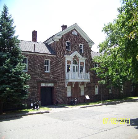
| Formerly a residential building. |
For other photos taken at the High Line, please see Pages RRRR and SSSS. More photos taken on Governors Island can be seen on Page SSSS. |
| 08/09/14 - This area has changed. The park is being extended to this point and a building is going up close by. |
| 08.09.14 - This no longer exists. There is now a building in its place! |
| 08.09.14 - This area was closed to pedestrians due to construction during the July 2014 visit (Page SSSS). Many of the dilapidated buildings have been torn down. |